
Kirkland Neighbors by Source
A block lookup works best when each source has one purpose. King County Parcel Viewer shows how lots touch. eReal Property adds public ownership and parcel facts. Kirkland's maps identify a civic neighborhood, while Neighborhood Services supplies public association contacts. None is a complete list of Kirkland neighbors, renters, guests, or family members.
| Source | What It Shows About a Block | Access |
|---|---|---|
| King County Parcel Viewer | Parcel outlines, addresses, and nearby lot relationships | Free public map |
| eReal Property | Owner, mailing address, property and tax context | Free public portal |
| Kirkland neighborhood maps | Named civic area and mapped boundary | Free city maps |
| Neighborhood Services | Association pages, meetings, chairs, and public contacts | Public city page |
| Historical directories | Published households or businesses from a stated year | Library, archives, or scans |
The owner field is tax-roll context. A mailing address different from the site address can be useful, but it does not prove a rental or identify an occupant. A voter record has strict use limits and is not a safe substitute for a neighborhood directory. Keep the claim narrow: the parcel record named an owner on the date checked.
Plot Kirkland Neighbors Nearby
Open King County Parcel Viewer and search the starting address or parcel number. Select the parcel, note its boundaries, then click each lot that directly touches it or faces it across the street. The viewer links selected parcels to eReal Property, district facts, and development conditions. iMap offers street-intersection and place search plus layers for property, planning, natural resources, and political boundaries.
The county's Parcel Viewer screen is the visual base for this method.
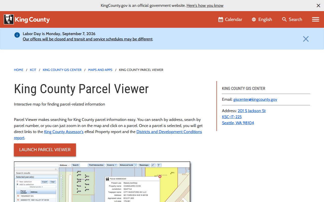
The screenshot shows why parcel geometry should come before names: it defines the block without guessing who occupies any building.
- Search the known street address and confirm the site parcel.
- Click each adjoining or facing lot, one at a time.
- Open the linked assessor detail and record the parcel number, owner field, and check date.
- Return to the map and repeat only for the immediate block.
Kirkland Neighborhood Lines Differ
Kirkland publishes maps for Bridle Trails, Central Houghton, Everest, Finn Hill, Highlands, Juanita, Kingsgate, Lakeview, Market, Moss Bay, Norkirk, North Rose Hill, South Rose Hill, and Totem Lake. These are civic boundaries. They do not necessarily match ZIP codes, census tracts, school areas, parcel jurisdictions, or postal city names.
The mismatch matters near older city edges. Houghton consolidated with Kirkland in 1968. Totem Lake joined in 1974, parts of Rose Hill and Juanita in 1988, and Finn Hill, Juanita, and Kingsgate areas in 2011. A current block may have older records filed under another locality label. Check the city's annexation map when a search returns nothing or an old address seems outside Kirkland.
- Parcel
- A legally defined piece of land with its own county identifier.
- Civic neighborhood
- A city or community boundary used for local identity and participation.
- Postal area
- An address-delivery area that may cross civic lines.
Kirkland Neighbors Organize Locally
Kirkland Neighborhood Services identifies 13 associations and the Kirkland Alliance of Neighborhoods, or KAN. The city page publishes association links, meeting details, chairs, and public ways to make contact. Totem Lake is listed as not currently active, so check the live page rather than relying on an old roster.
North and Juanita
Finn Hill, Juanita, Kingsgate, Evergreen Hill, and Totem Lake appear in the city network.
Central Kirkland
Market, Norkirk, Moss Bay, Highlands, and North Rose Hill publish civic contacts through the city page.
South and Houghton
Lakeview, Central Houghton, Everest, and South Rose Hill/Bridle Trails round out the listed associations.
Association pages can show events, public concerns, projects, newsletters, and meeting places. They are not resident rolls. Use a listed chair or email only as an organization contact, and rely on the association's own page for current leadership.
The Neighborhood Services capture shows the official entry point for these public groups.
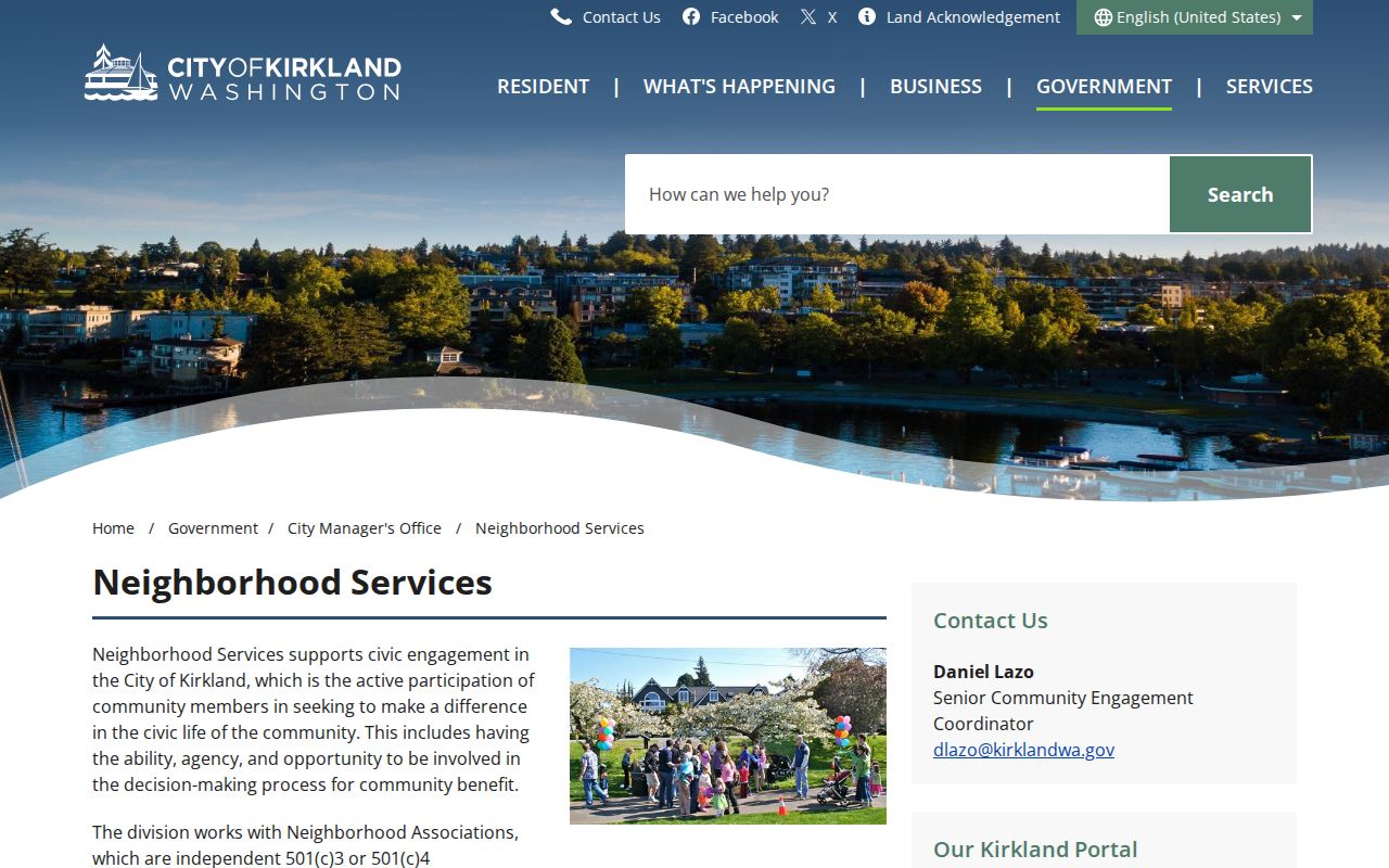
The city source keeps community contacts separate from claims about private households.
KAN Connects Kirkland Neighbors
KAN is the umbrella forum for Kirkland's neighborhood associations. The city says its meetings generally take place on the second Wednesday at 7 p.m. at City Hall. That public meeting path is more useful for learning about a block issue than trying to assemble names from scattered sources.
The Neighborhood Matching Grant program, established in 1996, supports open and inclusive groups with contiguous boundaries and a nonprofit or community purpose. A grant project address identifies a public activity, not every participant. Likewise, a newsletter byline or event photo should not be turned into a private neighbor profile.
Official Kirkland Block Records
Commercial neighbor tools often blend old addresses, guessed household links, and copied public data. Official sources are narrower but easier to audit. They show the custodian, the record date, and the exact field being reported. Use the official route when accuracy and context matter.
| Source type | Strength | Limit |
|---|---|---|
| County parcel and assessor | Current parcel, mapped lot, and owner record | Does not prove occupancy |
| City association page | Current public civic contacts and meetings | Not a member or resident list |
| Commercial compilation | May combine many old sources | Dates and identity links may be unclear |
Record the URL, portal name, parcel number, access date, and what the field proves. Redact private information in any saved image. If a county entry seems wrong, ask the county custodian to correct it rather than copying the error elsewhere.
Kirkland Blocks Changed Over Time
Modern density can hide an older rural or industrial record trail. Historic surveys describe Market and Norkirk houses, Rose Hill and Juanita lots, Finn Hill farms and orchards, and the lakefront's ferry and shipyard activity. World War II shipyard growth and more than 1,600 wartime dwelling units changed nearby communities quickly.
A historic directory or Sanborn map can show a past block in a stated year. It cannot identify your current neighbors. When a block history is the goal, label each fact by year and source. Use current Parcel Viewer geometry as the starting frame, then compare older locality labels and maps without blending them into present-day household claims.
Check a Kirkland Block
Keep the search radius small. An immediate block usually means adjoining parcels and lots directly across the street, not a broad sweep of a whole named road. The parcel number is the stable key linking the map to assessor details, permit context, and recorded documents. If the task expands to every address along the road, use the Kirkland street directory workflow instead.
Owner and occupant are different roles. A deed names parties to an instrument, and an assessor page names the owner used for tax purposes. Neither lists every person at the site. A permit may name an applicant or contractor who never lived there. State each role exactly as the source labels it.
Protect Your Kirkland Neighbors
Public maps do not show who is inside a home, who rents it, who gets mail there, or how people are related. Utility and delivery data are not public block directories. Washington's Safe at Home program under Chapter 40.24 RCW can replace a qualifying participant's address with a designated address and protect records. An apparent mismatch may therefore reflect a lawful safety measure.
Do not publish personal contact details copied from a parcel, voter, or civic source. If there is a real safety concern, use the appropriate city service or law enforcement channel. For a civic concern, contact the listed association or Neighborhood Services without naming uninvolved residents.
Lawful use. Find Kirkland neighbors only for lawful personal or civic reasons. Never use block records to watch, threaten, harass, or intimidate anyone.