
Walk a Kirkland Street Directory
A sound search begins with one complete address, not a guessed name. Confirm its postal form, locate the parcel, and save the parcel identification number, or PIN. The PIN is the most useful bridge among Kirkland and King County systems. Ownership on an assessor page is tax-roll context. A deed identifies parties to a recorded instrument. A historic directory shows what was printed in one year. Keeping those statements separate prevents a convenient match from becoming an unsupported claim about who lives there.
- Verify the mailing line with USPS, then locate the address in the King County Parcel Viewer. Record the map date, parcel boundary, PIN, and jurisdiction.
- Open eReal Property from the parcel. Compare the situs address, meaning the physical site, with any mailing address shown.
- Open nearby parcels from the map. Repeat the same checks for each lot rather than assuming one street number covers the whole site.
- Search the PIN, legal description, or party name in Landmark. Read the deed image when one is available.
- Check Kirkland permit records for building chronology. For an older household, move to a dated directory, census, or archival card.
This street-by-street sequence can establish the public trail around a property. It cannot name each occupant. If the task becomes a historical address study, the Kirkland city directories describe the surviving published collections without turning old entries into present-day claims.
Kirkland Street Parcel Keys
King County offers three related tools, and each plays a different role in a Kirkland street directory search. eReal Property holds the assessment detail. The Parcel Viewer supplies the map and lets a reader click adjoining lots. eMap is built around parcel and legal-map controls. A ten-digit PIN, entered without punctuation where required, is more stable than a typed street line and can lead from the map to tax detail and newer recorded documents.
| Official tool | Search controls | Useful result |
|---|---|---|
| eReal Property | Address, parcel/account, and name where the current view supports it | Site address, jurisdiction, legal or plat data, land, building, value, sales, and tax context |
| Parcel Viewer | Address, parcel number, zoom, or map click | Parcel boundary plus links to eReal, districts, and development conditions |
| Assessor eMap | PIN; quarter, section, township, range; levy code; map-update dates | Assessor map keyed to parcel and legal geography |
| iMap | Address, intersection, place, parcel, and layer controls | Real-property, planning, political, and natural-resource layers |
The successful King County Parcel Viewer capture shows the official entry point for a map-led search.
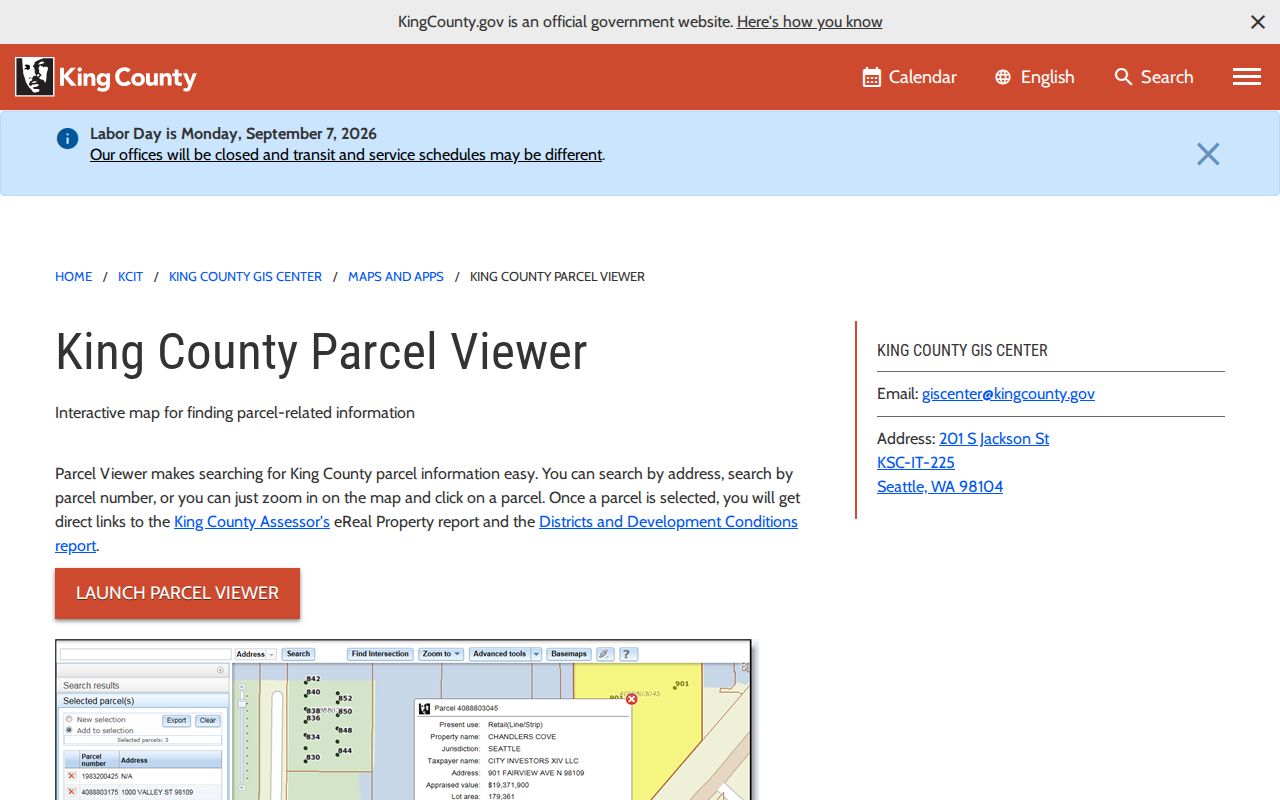
The viewer is the visual link between a street address and the parcel records that need closer reading.
Kirkland Records Indexed by Address
No single street directory contains the full Kirkland address record. The assessor, GIS center, Recorder, city permit system, archives, and voter custodian maintain separate sources. Their coverage and legal limits differ. Use the parcel number to connect sources, then cite each item on its own terms.
| Address source | Keeper | Evidence supplied | Access channel |
|---|---|---|---|
| Parcel and tax detail | King County Assessor | Situs, tax-roll owner context, legal description, building and sales fields | eReal web search; eMap; assessor links |
| Parcel geometry | King County GIS Center | Boundaries, nearby parcels, districts, planning layers | Parcel Viewer, iMap, or GIS Center contact |
| Recorded instruments | King County Recorder | Parties, type, recording date and number, legal description | Landmark from 1976; copy request; Recorder counter or mail |
| Historic recordings | King County Archives | General Recordings Index and grantor-grantee microfilm | Email, phone, scheduled research, or limited walk-in service |
| Building and project files | City of Kirkland | Case, parcel, role, status, dates, description | GIS/MyBuildingPermit; project map; focused public-record request |
| Historic listings | KHS, libraries, archives | Published names, addresses, phone or household context by year | Digital scans, library resources, archival appointment |
Washington voter information is not a substitute for this chain. Statewide extracts follow a controlled request process and statutory political-use limits. VoteWA is the voter-facing registration tool, not a public block directory. Protected fields and addresses must remain protected.
Note: A parcel, deed party, permit contact, and directory name may describe four different relationships to the same Kirkland address.
Kirkland Situs and Mailing Lines
The situs address is the physical location assigned to the parcel. A mailing address is where the assessor sends tax correspondence when that field appears. They may match, but they do not have to. The recipient might use an office, another home, or a post-office box. Neither line proves who is inside the Kirkland building today.
- Parcel
- A mapped unit of land with a county identification number and boundary.
- Situs address
- The physical address associated with the land or building.
- Plat
- A recorded map that divides land into lots, blocks, tracts, or easements.
- Criss-cross directory
- A published directory arranged by address or telephone number rather than only by surname.
Read the legal description as well. A lot and block, condominium unit, or quarter-section reference can survive a change in street form. It also helps distinguish adjacent parcels with similar addresses. When a Kirkland street search fails by address, a verified legal description is often the best next key.
Browse Kirkland Streets on Maps
The Parcel Viewer can turn one known address into a careful street-by-street survey. Select the first polygon, note its PIN, open its eReal link, then return to the map and click the parcel next door. Pan along the named street and repeat. iMap can add an intersection search and show planning, political, real-property, or natural-resource layers. These layers explain boundaries. They do not reveal household members.
Assessor eMap is useful when the research begins with a parcel or legal map reference. It accepts the ten-digit parcel number, quarter-section-township-range fields, city levy code, and map-updated date range. Date inputs use the format shown by the portal. It is not a ZIP-wide or occupant search.
The King County eMap source provides the parcel and legal-map controls used beside the by-address workflow.
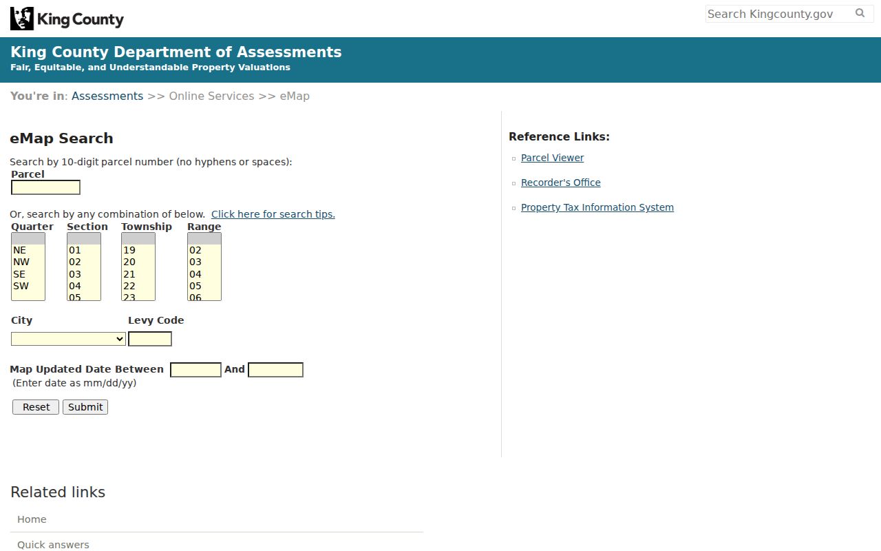
This screen reinforces why a PIN or legal-map description is a stronger search key than a loose neighborhood label.
Kirkland Street Permit Records
Kirkland permit and project records add a building timeline to an address. The City construction-project map accepts an address and can show status, description, background, and interactive detail. MyBuildingPermit supplies application, inspection, and status paths. Useful fields include the case number, jurisdiction, parcel, address, project role, applied or final dates, status, and description.
Roles require care. A named applicant may be a contractor, designer, public agency, or representative, not an owner or resident. A project pin can sit on a neighboring parcel. Confirm both the jurisdiction and PIN before attaching a permit to the Kirkland address record. King County's permit search serves unincorporated areas, so it is not the default route for a parcel inside city limits.
If a city record is not in the portal, submit a focused request through the Kirkland public-records route. Include the address, parcel, date range, project type, and likely department. Under Washington's Public Records Act, the initial response is due within five business days, but that response may be a link, clarification request, estimate, production, or supported denial.
Kirkland Deeds Along One Street
Landmark is King County's recorded-document index for 1976 forward. Its searches include party name, document type, book and page, consideration, recording number, parcel ID, record date, legal description, and advanced legal fields. Parcel identifiers were not used consistently until about 2002, so an older street search may require a seller name or legal description instead.
Images generally begin with instruments recorded August 1, 1991. An indexed item from 1976 through July 31, 1991 may require a copy request. Before 1976, contact King County Archives for the General Recordings Index and grantor-grantee microfilm covering 1853 through 1975. Archives research can begin by email or phone, and research-room work requires an appointment. This fallback matters when the web index appears to stop.
The successful Landmark deed-index capture shows the official tabs for recorded-document research.
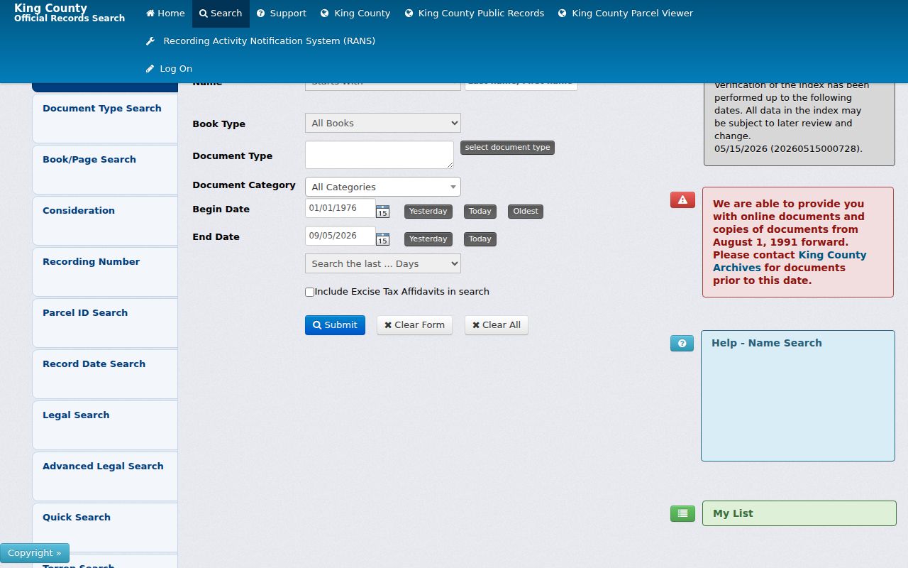
A search result must still be checked against the instrument image, legal description, recording number, and any rerecording or exception.
Kirkland Streets Across Annexations
Historic labels are a real search issue in Kirkland. Houghton consolidated with the city in 1968. Totem Lake was annexed in 1974. Rose Hill and Juanita areas changed in 1988, while Finn Hill, Juanita, and Kingsgate joined on June 1, 2011. Earlier directories, permits, deeds, census schedules, and maps may therefore place a current Kirkland address under another community or unincorporated King County.
The City GIS Maps page includes annexation history and neighborhood maps. Test the parcel under the older locality label before treating a missing result as proof that no record exists. Rural parts of Rose Hill, Juanita, and Finn Hill also had gaps in older permit and address directories. A legal description, historic map sheet, or plat can bridge those gaps better than a modern street line.
No authoritative citywide renumbering table or single renumbering year was found. For a suspected street change, compare the old directory, Sanborn or other map, plat, recorded legal description, and present GIS. Then ask Kirkland Planning, Public Works, or the City Clerk for the ordinance or address-assignment file.
Note: A no-result may reflect an annexation label, index cutoff, spelling format, redaction, or protected address rather than an absent record.
Kirkland Street Listings by Year
For past households, use a dated publication. Kirkland Heritage Society provides digitized 1888 and 1910-11 Polk material, a 1930 address scan, and early phone books from several runs between 1914 and 1950. The scans may include a spouse, widow notation, occupation, business, phone, or locality code. They remain snapshots, not full censuses.
Read the abbreviation key and full entry. The 1910-11 directory can place a person in Kirkland civic or business life while marking the home as Seattle. Phone books omit unlisted numbers and may lag a move. A Sanborn map supplies structure and use, not an occupant. Pair the published entry with a census, deed, or parcel source from the same period.
The Washington State Library's access changed in 2025 and now uses limited Thursday appointments by email. Useful alternatives include KHS scans, KCLS, Seattle Public Library genealogy help, King County Archives, the Puget Sound Regional Branch, and FamilySearch. Cite the volume, year, page or image, repository, and access date.
Limits of Kirkland Street Records
A Kirkland street directory built from official records still cannot show every resident. Parcel tools show land and tax context. Deeds show parties to instruments. Permit records name project roles. Directories omit some households. Utility customer lists were not verified as public, and federal law restricts motor-vehicle personal information. Safe at Home can cause a qualifying participant's address to appear different or remain absent.
Do not infer a household from a shared mailing line, surname, parcel, or voter clue. A postal ZIP confirms delivery geography, not occupancy. Missing data can reflect an exemption, a record cutoff, a different custodian, an old locality, or simple index variation. Record exactly what each result proves and what it does not.
Lawful use. Use Kirkland address records for lawful property, family-history, civic, or personal research. Never use them to stalk, harass, intimidate, or uncover a protected address.